F2
Leander, Texas
Thursday, March 16, 2000 around 4 pm
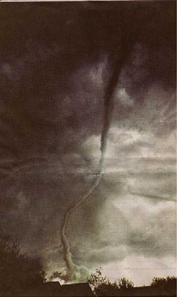
Peter Yang photographed the funnel cloud from Blockhouse Creek about
3 miles away as I stood directly underneath the cloud base seen at the bottom of the funnel. The cloud base was turning very slowly and drifted slowly Northeast. It was so close to the ground that I mistaked it for a wall cloud since I could see no funnel.The wall cloud if there was one, would be seen near the top of the photograph several thousand feet higher. Once the funnel became a tornado it reversed it's direction and followed a Southeast track through Mason Creek. I was standing on my front porch when the tornado reached my house. Using the Fujita Scale table below as a guide, it appears that we received F1 level damage while the houses behind ours sustained damage closer to F2 levels.
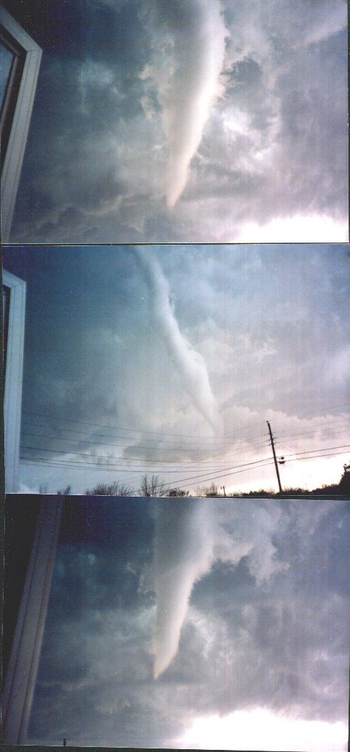
Photos from Glass Street in Leander about a mile from
ground zero
Courtesy of Jim Kinter Jr. K5KTF
| F-Scale Number |
Intensity Phrase | Wind Speed |
Type of Damage Done |
|---|
| F0 | Gale tornado |
40-72 mph | Some damage to chimneys; breaks branches off trees; pushes over shallow-rooted trees; damages sign boards. |
|---|
| F1 | Moderate tornado |
73-112 mph | The lower limit is the beginning of hurricane wind speed; peels surface off roofs; mobile homes pushed off foundations or overturned; moving autos pushed off the roads; attached garages may be destroyed. |
|---|
| F2 | Significant tornado |
113-157 mph | Considerable damage. Roofs torn off frame houses; mobile homes demolished; boxcars pushed over; large trees snapped or uprooted; light object missiles generated.
|
|---|
| F3 | Severe tornado |
158-206 mph | Roof and some walls torn off well constructed houses; trains overturned; most trees in fores uprooted |
|---|
| F4 | Devastating tornado |
207-260 mph | Well-constructed houses leveled; structures with weak foundations blown off some distance; cars thrown and large missiles generated. |
|---|
| F5 | Incredible tornado |
261-318 mph | Strong frame houses lifted off foundations and carried considerable distances to disintegrate; automobile sized missiles fly through the air in excess of 100 meters; trees debarked; steel re-inforced concrete structures badly damaged. |
|---|
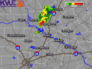
Radar showing the line of thunderstorms that produced this tornado
(captured by Leander Fire Dept)
This is a re-enactment of the ground zero view I had of the tornado at the moment I retreated to cover just milliseconds before it hit Mike and Kelly Bouldin's home. Ronald Taylor's roof is the simulated debris here, and this image depicts the picture in my mind that I shall never forget. Notice that except for the swirling roofing material, the tornado was otherwise invisible to me.
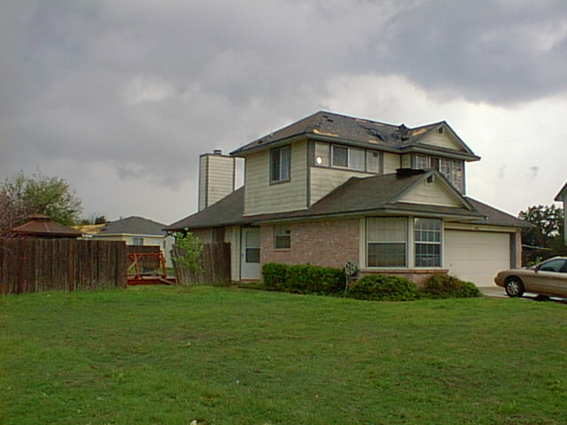
The Bouldin house on Greening Way showing classic F2 tornado damage. This is where I began my house to house search for injured neighbors. I found a very shaken but uninjured Bouldin family inside.
The side of Ron Taylor's home showing the area very near touchdown.
Front of our house showing F1 levels of roof damage. Our Border Collie Shiloh escaped the tornado through the opening in the fence and hid under a bed for hours. She was presumed lost until I noticed a tail wagging under the edge of the bed some 3 1/2 hours later. Fortunately, the tornadic wind blew and held both front doors open for her.
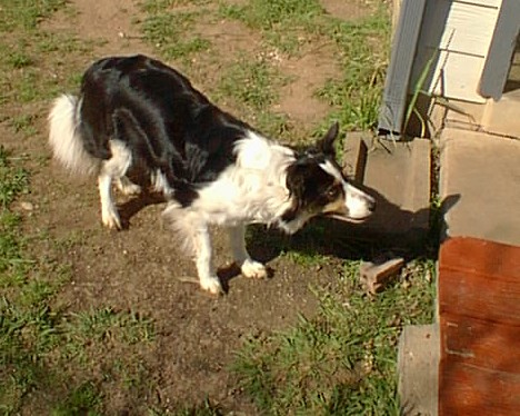
Shiloh (on a nice day)
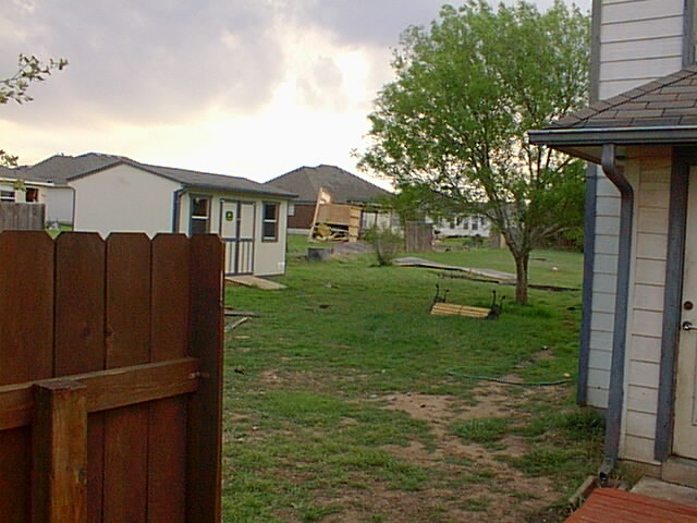
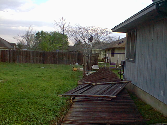
Path of the twister through our backyard. Amazingly our storage building suffered no damage other than minor paint scuffs from flying debris. The storage building one door down in back of ours was tipped and rolled a short distance.
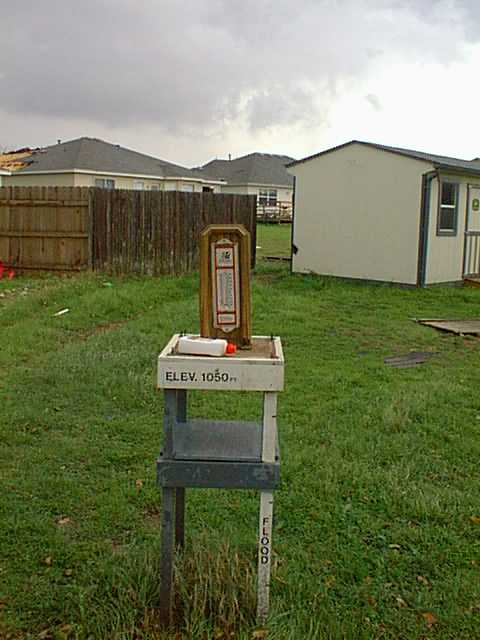
The top was ripped off of my weather instrument shelter leaving the thermometer and charcoal fluid untouched. The late Lou Withrow was the MIC at the Austin National Weather Service office when I received my Severe Weather Spotter Training. Lou was my Skywarn instructor and helped me design and build the instrument shelter.
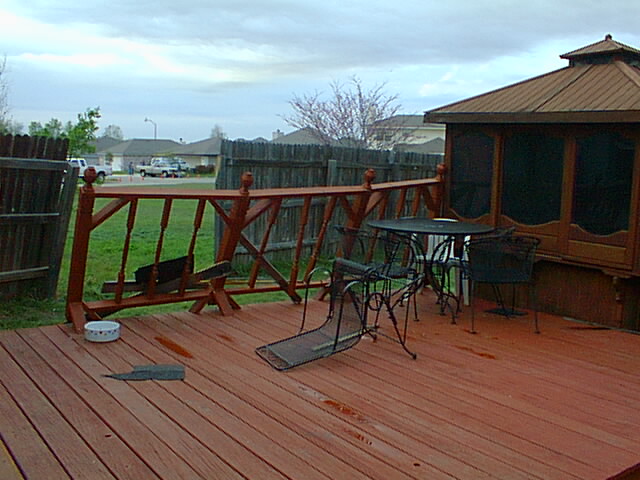
A shot showing the general direction that the twister came from and the damaged deck railing that I built just 1 month ago.
View of the tornado's path from behind our storage building.
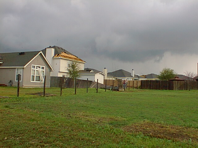
Only posts remain in a 125 foot fence as Caroline and John Olenoski survey their F2 category roof damage. Only three fence sections can be accounted for. The rest are just gone.
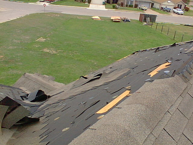
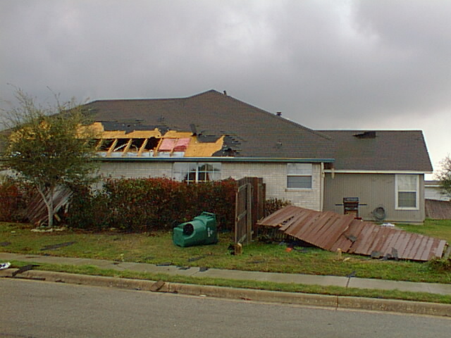
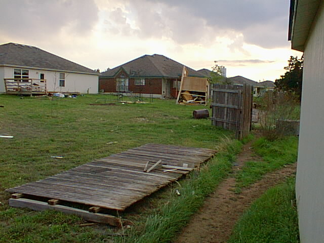
Largest section of our F1 roof damage. Building materials donated by local lumber companies appear at the edge of Mason Creek Blvd.
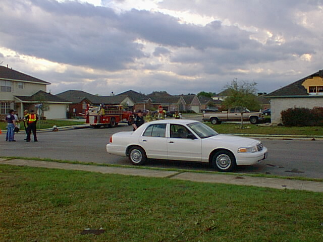
Leander Police seal off damaged areas from onlookers and potential looters as firemen search for gas leaks and cut power.
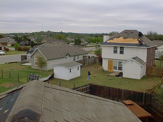
Caroline looks on as repairs commence on her roof.

Skywarn is a nationwide network of trained Severe Weather Spotters
such as myself. The National Weather Service does not sponsor spotters directly or fund their activities, but they do provide the training for spotters and most NWS offices are equipped with amateur radio base stations so that spotters can relay credible real-time reports to the NWS.
Modern doppler radar is excellent for tracking and forecasting severe weather events; however, it cannot equal or replace trained eyes in the field.
Severe weather observation near storms can be risky; therefore, fame and glory is not what the Skywarn program is about. We are driven solely by a desire to contribute accurate information as a team to the NWS in an effort to save lives and property via the earliest warning possible.
E-Mail message I received from the National Weather Service on March 22, 2000:
Stephen,
Thank you for your message. Although I only had time for a quick scan at your
web page, it looked great. I've bookmarked it for when I can take my time and
really enjoy reviewing it. I agree that the damage in your subdivision was F2
in places, with most of the damage in the F0 or F1 range.
Thank you for your account in this tornado outbreak - it will be very helpful
when I write our Storm Data report.
Larry Eblen

Web page design and all photography (except tornado pic)
by:
Steve Culp
Severe Weather Spotter WI-1